i Jubilee Arête - Jubilee Ridge - Jubiläumsgrat
i One of the most spectacular alpine climbing routes in Europe
i 8.1 km, 8.5 hours, D or 3-
O Augmented Reality Experience for iOS 11 devices and Microsoft HoloLens
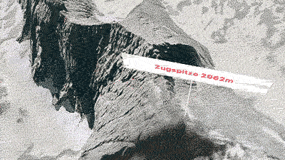

+ Explore the famous climbing route starting at Zugspitze (2,962 m / 9,718 ft)
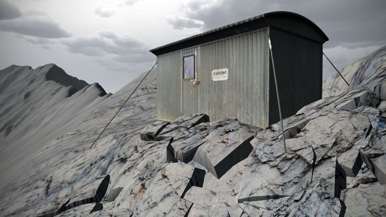
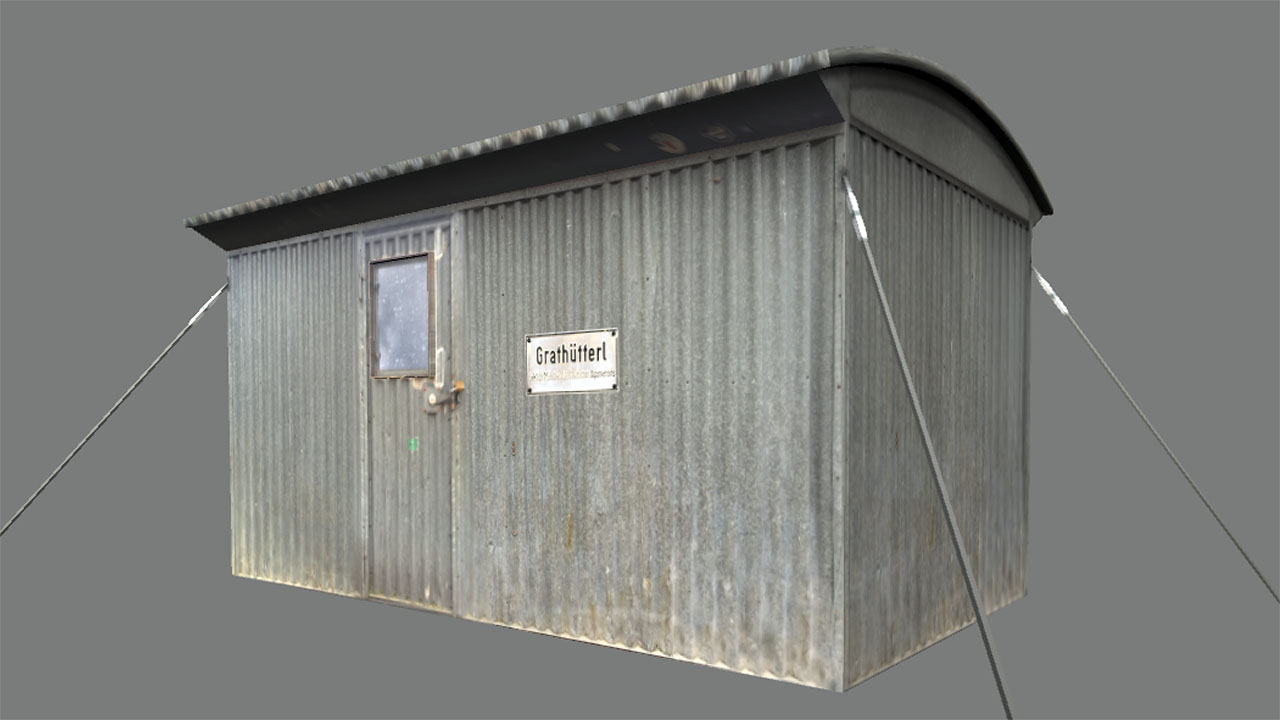
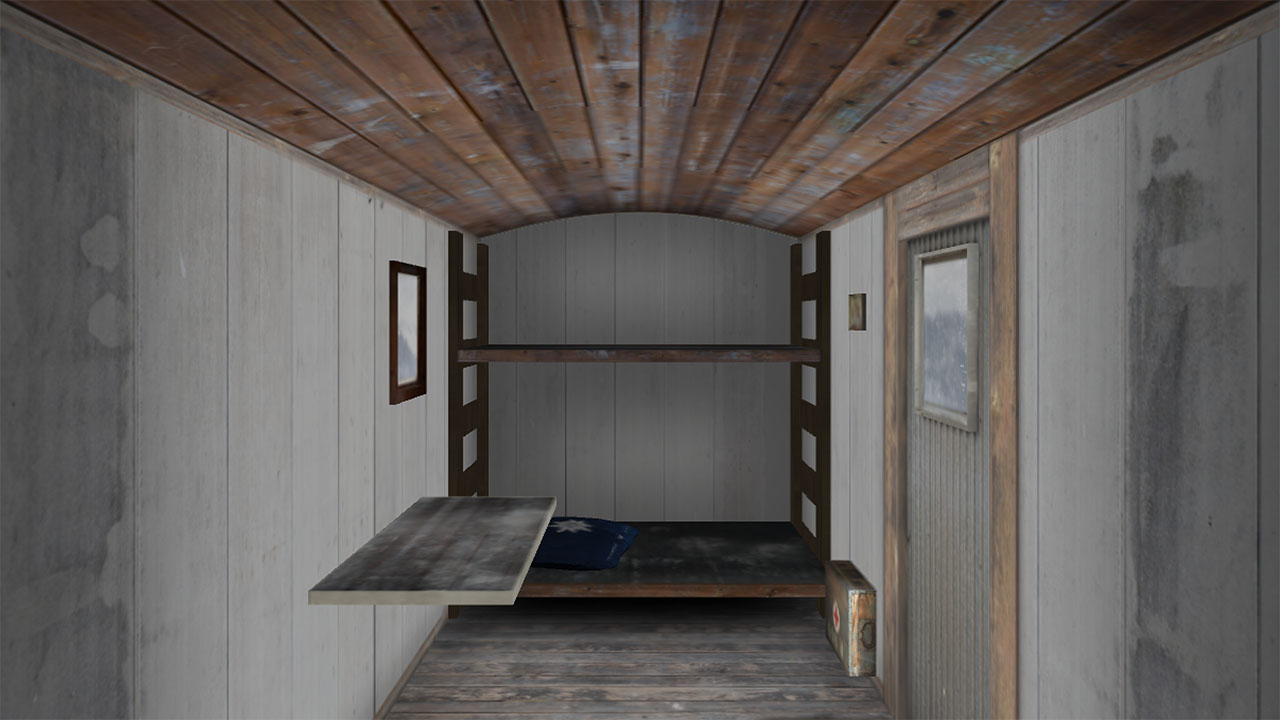
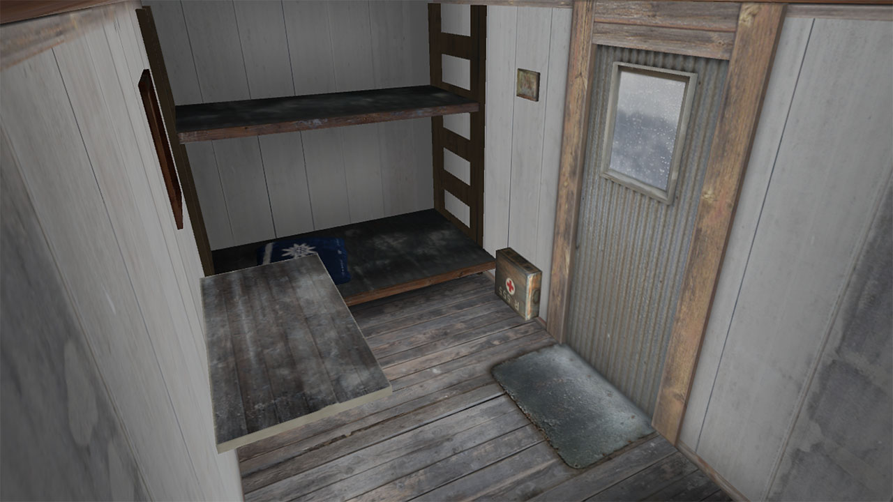
+ Enter the historic bivouac shelter (1965 - 2013)
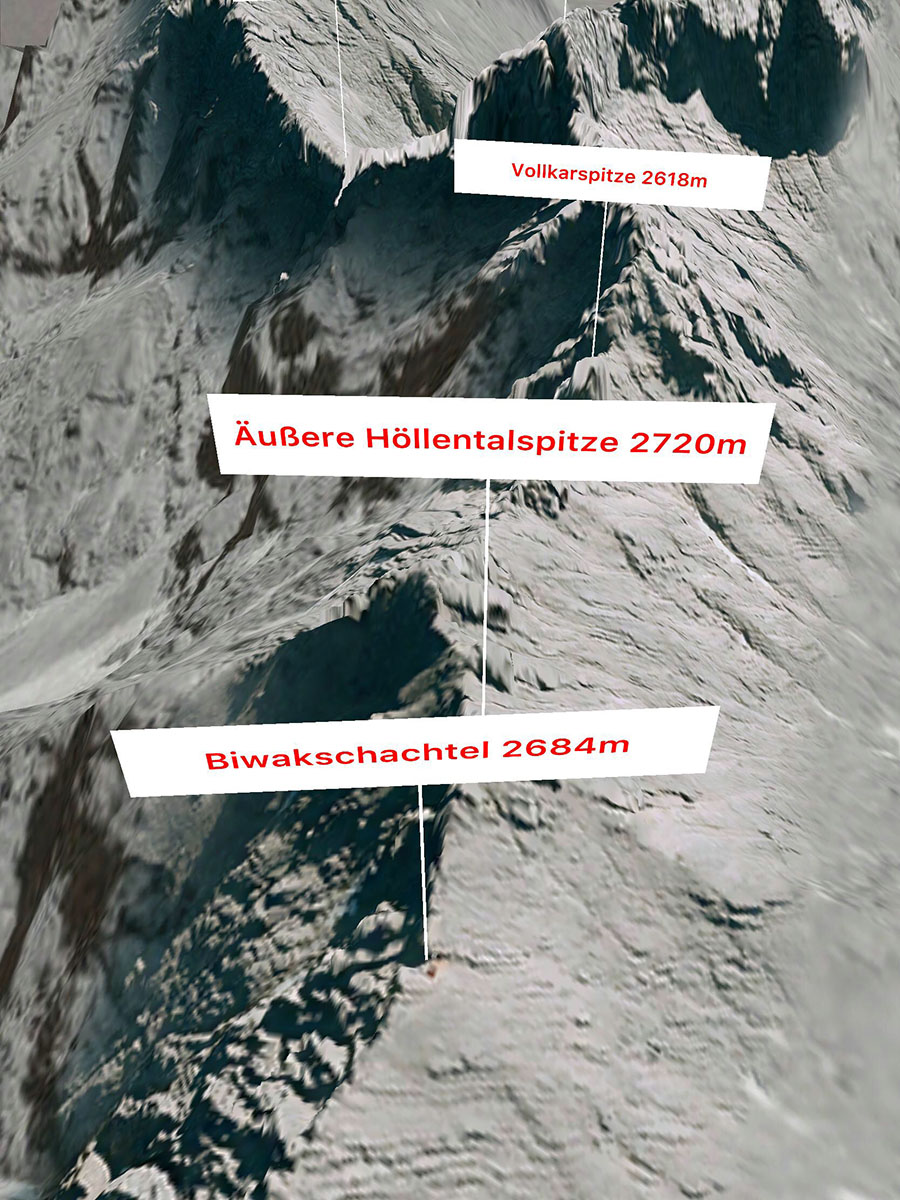
+ View aerial photos for all peaks and landmarks
+ Measure distances by placing pins via touch or Air Tap
+ Control menus, brightness and rotation with gestures or voice commands
+ Enter the historic bivouac shelter (1965 - 2013)
+ View aerial photos for all peaks and landmarks
+ Measure distances by placing pins via touch or Air Tap
+ Control menus, brightness and rotation with gestures or voice commands
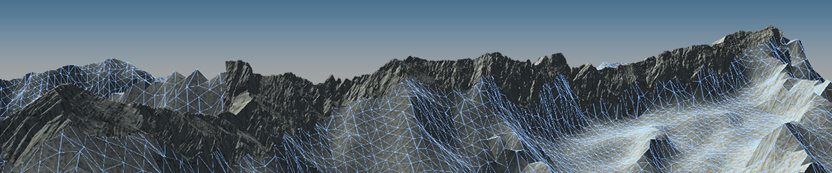
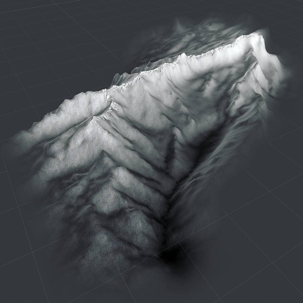
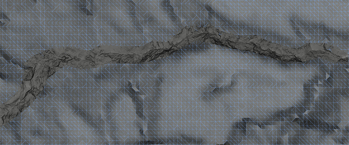
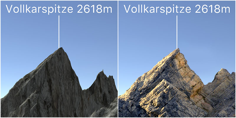
i Optimized terrain with 300k+ triangles
i Digital elevation data from airborne laser scanning
i Terrain grid resolutions: ridge 1m, background 50m
i Aerial photography resolution 20cm
i Geobasisdaten © Bayerische Vermessungsverwaltung
i Digital elevation data from airborne laser scanning
i Terrain grid resolutions: ridge 1m, background 50m
i Aerial photography resolution 20cm
i Geobasisdaten © Bayerische Vermessungsverwaltung

i Grathüttl / Bivouac shelter 1965 - 2013
I Digital elevation data vs. photography (© Wikipedia)
H Home
©2018 FLAUCHERS FINEST - Geobasisdaten © Bayerische Vermessungsverwaltung - Privacy